SunTrail Florida Logo

The Collier to Polk Regional Trail Master Plan will define the initial vision for a connected multi-use trail through Collier, Hendry, Glades, Highlands, Hardee, and Polk counties.

The Master Plan will evaluate the possibilities for the trail through:

  • Analysis of existing conditions in the study area
  • Review of current trail planning and programming
  • Identification of communities, destinations and attractions that the trail could connect
  • Engaging the public and stakeholders for input

Based upon this information, High-Level Concepts will be defined for where the trail could be located.

The Master Plan will include useful guidelines, provide an Action Plan with implementation recommendations for a clear path forward, and set the stage for future project development.

Provide Visual Story to Illustrate the Possibilities

Define Recommendations for Clear Path Forward

Set Stage for Future Project Development

Collier to Polk Trail Map

The vision for the Collier to Polk Regional Trail is to provide a continuous multi-use trail that traverses Collier, Hendry, Glades, Highlands, Hardee, and Polk counties. The trail will connect small towns, natural areas, and working lands to help users experience the region’s culture, environment, and history. When completed, the Collier to Polk Regional Trail is expected to be over 200 miles and will connect to other regional trail systems such as the Florida Coast to Coast Trail and Florida Gulf Coast Trail.

Click here to view map full screen

Helpful mapping tips.

Use the tools at the top right of the map frame to change basemaps, toggle layers on/off, and make measurements in the map. 

layertogle

Use the bookmarks to the right of the map to explore each county.
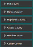
countytoggle

Master Plan Map

Master Plan Schedule